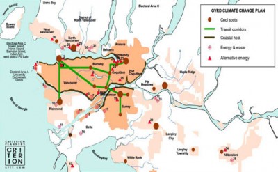
Cool spots’ – Identifying low carbon neighborhoods

A picture is worth a thousand words, which is why the folks at the GIS savvy planning firm Criterion created a tool to not just analyze where to best invest in low-carbon development, but to illustrate it.
The concept is referred to as Cool Spots, and is described as “places where land use, transportation and energy data converge to create the best places for low-carbon development.”
The process, as described in more detail here:
 1. Analyze the region’s energy usage, from CO2 building emissions to transportation, using existing GIS information.
2. Map the walkable areas around transit nodes and commercial corridors, as well as major destinations, as displayed in the image to the left. Notice that it also defines areas that should be conserved.
3. Utilize this data to suggest development sites that improve transportation choice and energy infrastructure efficiencies (top image).
4. Attract new low-carbon (ie cool town) development to those sites.
Read a full review or download the program.

Leave a Reply