
A ‘Google Maps for pedestrians
Say you live in a walkable city and want walking directions as opposed to driving directions to a destination across town. You’re in luck if you live in London and perhaps soon in Boston, thanks to Walkit, a Mapquest for people on foot.
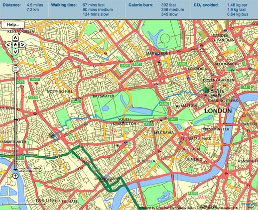
Check out the map above – notice how the suggested walking route cuts right through several parks and with no regard for one-way streets. It even calculates calories and CO2 saved based on walking speed and compared to other means of transportation. You can even choose low pollution routes that avoid ambling near heavy traffic.
It’s a nice complementary tool to Walk Score, which rates how walkable a given city address is.
Leave a Reply